National Coat of Arms
Official Website
Department of Survey and Mapping Malaysia
Ministry of Natural Resources, Environment and Climate Change
  • Soalan Lazim
    Frequently Asked Questions
  • Soalan Lazim
    Contact Us
  • Soalan Lazim
    Site Map
  • 30 Mar 2023 / 08 Ramadhan 1444H
    W3C
    BM ENG
    1. Font Color

    1. Font Size

      A   A   A  

    1. Bantuan

      Manual

Frequently Asked Questions
  • Main Page
  • Frequently Asked Questions
  • Corporate Information
  • Current Information
Main Menu
Main Menu
Staff Directory
JUPEM Staff
General Public
  • General

  • Mapping

  • Cadaster

How to get the JUPEM digital data?

To get JUPEM digital data, the user has to apply for the Copyright License of RM 200.00 (private sector/higher education institutions) and RM 100.00 (government sector) a year. Application for the data can be done by filling out the PPNM-1 (Pind.1/2008) form (Permohonan Lesen Hakcipta/Membeli Dokumen Geospatial Terperingkat) through eBiz system at https://ebiz.jupem.gov.my/.

How to obtain and purchase districts map, states map and map of Malaysia?

Districts, states and Malaysia’s map are available at sales centre at all JUPEM’s offices and headquarters or through eBiz system at https://ebiz.jupem.gov.my/. For more information, please visit eBiz’s website under the item Product.

How to obtain the electronic map (e-Map)?

Electronic maps are sold in Compact Disc media (Edition 1) for RM10.00 per unit while in Flash Drive media (Edition 2) for RM36.00 per unit including storage media cost.
It is available at the Customer Service Center at JUPEM Headquarters or at the sales counter at JUPEM State or online through the eBiz system at https://ebiz.jupem.gov.my.

Are they any restrictions for mapping data be used for navigational purpose?

The mapping data can be used for navigational purpose after the data has been scrutinized and approved by Defense Geospatial Division, JUPEM. The processes data has to be sending back to JUPEM for approval before releasing the data.

How to subscribe MyRTKNet Application?

Please visit https://ebiz.jupem.gov.my/KB/Published/40 (Malay only).

How to subscribe Digital Data Application??

Please visit https://ebiz.jupem.gov.my/KB/Published/40 (Malay only).

How to subscribe Restricted Data Application?

Refer to No. 1 above, please visit https://ebiz.jupem.gov.my/KB/Published/38 (Malay only).

Who are eligible to apply Industrial Training/Practical in JUPEM?

Students are Malaysia citizen who are studying in public or private educational institution either local or abroad which is recognized by Public Service Department (JPA). Students from related course to the survey and mapping will be given priority.

How to apply Industrial Training/Practical in JUPEM?

All applications must be submitted to Planning & Corporate Division, JUPEM Headquarters, Kuala Lumpur with the details below: 
i.    Letter of Industrial Training from faculty or university;
ii.    Letter of Application (Please state the preferred place);
iii.    Resume; and 
iv.    Exam Transcript for the previous semester.
Send the following details via email to kompetensi@jupem.gov.my

Will student be paid allowance?

The practical allowance is RM 5.00 per hour (max 8 hours per day) and limited to 90 working days only. However, it is subject to the current finances of the Department.

Can student eligible to apply for a leave during industrial training/practical?

Student are not eligible to take leave except by supervisor permission with reasonable excuse. Leave day will be not paying the allowance.

What are the documents required for the payment of industrial training allowance?

i.    Practical Training Acceptance Letter from JUPEM;
ii.    Copy of Punch Card/Thumb Print Report or any Attendance Report verified by JUPEM Supervisor;
iii.    Copy of Mykad; and
iv.    Copy of bank account statement (front page stated with name, Mykad numbers and account numbers)
For any enquiry regarding industrial training/practical, kindly contact us with the following details:
Competency Development Section,
Planning & Corporate Division,
13th Floor, Wisma JUPEM
Jalan Sultan Yahya Petra 
50578 Kuala Lumpur
No. Tel: 03-2617 8022/ 03-2617 0823
No. Fax: 03-2617 0636

Email: kompetensi@jupem.gov.my

How to apply for jobs in JUPEM?

Applications for employment in any government agencies included JUPEM must be made through Public Service Commission Job Registration System (SPA9), which is available at their website http://www.spa.gov.my/. 

How the fees of mapping and survey data determine?

The fees for mapping and survey data are determined by referring to Fees and Payments (Services, Survey and Mapping Data and Reproduction) Order 2010.

Is it possible for the restricted data to be carried abroad for the processing purpose?

If the restricted data is to be carried abroad for the processing purpose, the Undertaking by Appointed Consultant/Contractor Form has to be filled in, and one (1) staff from JUPEM must accompany the data and the cost incurred will be supported by the appointed company.

It is possible for company/agency instead of JUPEM doing the collection of mapping and survey data?

All companies/agencies who intend to collect mapping and survey data must apply to JUPEM for approval. After the data has been processed, it must be scrutinized by JUPEM before it can be used

How to obtain KPUP Circulars and Circulars Letter?

KPUP Circular and Circulars Letter are available at JUPEM Official Portal at https://www.jupem.gov.my/page/circular-letter. 

How to make a reference for the application of aerial photographs?

Reference for the application of aerial photographs can be made to the National Map Library at Level 1, Bangunan Ukur, Department of Survey and Mapping Malaysia, Jalan Sultan Yahya Petra, 50578 Kuala Lumpur or through eBiz system at https://ebiz.jupem.gov.my/. 

How to apply Small Estate Distribution?

Application for small estate distribution are only managed by the Department of Director General of Lands and Mines (JKPTG). Please visit JKPTG Official Portal at www.jkptg.gov.my for more information.

What does drone/UAV/UAS flight have to do with JUPEM?

JUPEM plays a role in the security of classified geospatial information in Malaysia. According to General Circular No. 1 of 2007: Classified Geospatial Information Security Instruction Circular, each drone/UAV/UAS operation equipped with a camera or any sensor is categorized as an imaging and data capture operation. Therefore, it must have written permission from the Director-General of Survey and Mapping Malaysia.

Does drone/UAV/UAS operations for hobbies/competitions/research need to get JUPEM permission?

Permission from JUPEM is subject to drones/UAV/UAS which are equipped with cameras or sensors only. Other than that, the operation must be referred directly to the Civil Aviation Authority of Malaysia (CAAM).

How to get approval from the Director General of Survey and Mapping Malaysia?


a.     Each information must be filled in completely. Incomplete applications will be returned immediately.

b.    The documents that need to be attached are as follows:

        i)     Softcopy of applicant's identity card/passport.

        ii)    Softcopy of identity card/passport for the pilot, drone/UAV operator, photographer and vehicle
               operator (if possible Malaysian citizen).

       iii)    Softcopy of letter of appointment (LOA) from the ministry/project owner if the data collection/aerial
               filming activity involves other parties.

                •    If the application is from Sarawak, a letter of approval from the Sarawak Chief Minister's Office
                      is required after obtaining the letter of appointment (LOA).

                •    If the flight operational is within the international border area (Malaysia-Thailand, Malaysia-
                     Singapore, Malaysia-Indonesia and Malaysia-Brunei Darussalam), a special approval letter
                     from the Office of the Chief Government Security Officer of Malaysia (CGSO) is required.

        iv)    Softcopy of passport for Non - Malaysian pilot/UAV operator/photographer (if there is a need for
                professional visa admission).

        v)    Softcopy of SSM/Company Registration Certificate.

       vi)    Softcopy the letter of permission from the owner of the building/area involved.

c.    Foreigners who wish to operate drones/UAVs in Malaysia must engage with local qualified
       authorities/universities/companies/drone pilots in order to fulfil the requirement of the application.

d.    Each complete application must be submitted 2 weeks before the flight planning date (except in
       emergency/safety/disaster situations).

e.    All raw and latest data/photographs must be prepared in 3 copies (hardcopy/digitized) before being
       submitted to JUPEM. 

f.     Each permit application will be charged RM50 per day. Payment can be made through the eBiz system.

How to obtain utility mapping data?

One can write in officially or email to Planning and Corporate Division (hqweb@jupem.gov.my). As utility mapping data is a restricted/classified as geospatial data, the application must be attached with:


i) Borang PPNM-1 (Pindaan 1/2008).
ii) Appendix for JUPEM Supplier-Purchasing of Classified Geospatial Documents.


Both forms can be downloaded from JUPEM Official Portal: /page/download-mapping-form


Send the letter with the above forms to:


Director of Survey
Planning and Corporate Division
Department of Survey and Mapping Malaysia
13th Floor, Wisma JUPEM
Jalan Sultan Yahya Petra
50578 Kuala Lumpur

How can I made an application to use the Underground Utility Detection Test Base?

One can write in officially or email to (utility@jupem.gov.my) or directly through the following websites;

The letter can be sent to:

Director of Survey
Utility Mapping Division
Department of Survey and Mapping Malaysia
4th Floor, Bangunan Ukur
Jalan Sultan Yahya Petra
50578 Kuala Lumpur

OR

Booking application via website:
https://aruums.jupem.gov.my/faq/permohonan 

How the depth information of the underground utility data are shown in Map Utility?

The depth is shown relative to ground level i.e: positive (+ve) for the underground.


What is the coverage size of the Utility Map area?

250 meter x 250 meter.

What is the color coding and marking of the position of all the existing underground utility installation alignment obtained via field detection techniques?

No Type of Utility Code Colour
1 Electric Cable P Red
2 Water Pipe W Blue
3 Gas, Oil or Petroleum G Yellow
4 Communication cables include all type of fibre cables T Orange
5 Sewerage S Green
6 Unknown utility U White

Source : Director General of Survey and Mapping Circular No.1 Year 2016
(Garis Panduan Kod Warna dan Penandaan Utiliti Bawah Tanah)

What is JUPEM’s specification for digital data of underground utility installation works carried out by a Licensed Land Surveyor (LS) for the purpose of submitting to the State Department Survey and Mapping?

i. Data should be either in GIS shapefile (shp), Geodatabase (gdb) or Mapinfo (TAB).
ii. The coordinate system must be in GDM200 system - Rectified Skew Orthomorphic (RSO) and GDM2000 Cassini Soldner.
iii. The features detail code are based on Malaysian Standard Geographic Information/Geomatics Features and Attribute Codes (MS1759:2015).


Source : Director General of Survey and Mapping Circular No. 2 Tahun 2016
(Garis Panduan Penerimaan Data Digital Dan Pelan Utiliti Dari
Juruukur Tanah Bertauliah (JTB) Oleh Jabatan Ukur Dan
Pemetaan Malaysia (JUPEM))

Apart from JUPEM, who can perform underground utility detection surveys?

Licensed Land Surveyors (JTB) who has a Competency Certificate in Underground Utility Detection Survey (CUUDS) or Competency Certificate in Underground Utility Detection and Mapping (CUUDM) issued by the Land Surveyors Board Malaysia (LJT) are qualified to perform underground utility detection survey work.

List of licensed land surveyors who can perform utility detection surveys?

Licensed Land Surveyors (JTB) that have Competency Certificate in Underground Utility Detection Survey (CUUDS) or Competency Certificate in Underground Utility Detection and Mapping (CUUDM) are qualified to undertake underground utility detection survey works. The list of JTB names are displayed in the Land Surveyors Board Malaysia (LJT) portal.

http://www.ljt.org.my/search-speciality

Is data/information related to wind/wave speed available at JUPEM?

No. JUPEM only provides tidal data which consists of prediction data and observation record from stations operated by JUPEM. For data/information related to wind speed or wave conditions, it can be obtained from other agencies such as the Malaysian Meteorological Department (MET Malaysia) or the National Water Research Institute of Malaysia (NAHRIM).

Can tide information be accessed online?

Tide prediction information can be accessed online for FREE. The highest and lowest daily water level information is displayed but limited to a period of 2 days only (current day and next day). 

Website: https://www.jupem.gov.my/stapsMaklumat ramalan air pasang surut boleh diakses secara dalam talian dengan percuma. Maklumat paras air harian tertinggi dan terendah dipaparkan hanya terhad kepada tempoh dua (2) hari sahaja (hari semasa dan hari berikutnya). 

Laman web: https://www.jupem.gov.my/staps

What are the types of tidal information provided by JUPEM?

There are two (2) main products related to tidal:
i.    Tide Prediction Tables; and
ii.   Tide Observation Record.

What is the price for tide information?

The Tide Prediction Tables and Tide Observation Book, each cost RM50.00 per copy. The tidal information covers all stations nationwide for a period of one year. This information is also available in softcopy (*.pdf format)

Monthly information can also be obtained in the form of softcopy (*.pdf format). This information costs RM5 for each station per month.

How do I get tide information?

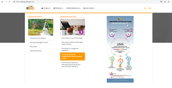
Tide Prediction Tables and Tide Observation Record books can be purchased at the Customer Service Centre at the JUPEM Headquarters or any JUPEM State counter. Online purchases can also be made through the eBiz application on the JUPEM Portal.

Which section can be referred to if there are questions related to Tidal Water?

Vertical Reference Infrastructure Section, Geodetic Survey Division, JUPEM Headquarters. 7th Floor, Bangunan Ukur, Jalan Sultan Yahya Petra, Kuala Lumpur. Telephone: 03-2617 0974 / 03-2617 0606 / 03-2617 0620.

Why need to change to eKadaster?

Malaysia has practiced Cadastral Surveying since 1885 and it is more than 135 years in practice. Therefore, this practice should be updated in accordance with the capability and advent of technology of ICT, GIS and GNSS. eKadaster application was first introduced in 2010 as a move to improve the delivery system of title survey. All 13 JUPEM States, Licensed Land Surveyor (LLS) and Land Related Agencies (ABT) in Peninsular Malaysia as well as the Federal Territory of Labuan adopted it.

What are the hardware and software requirements that are necessary in the eKadaster environment?

eKadaster system is a fully web-based application. The application is only compatible with Windows operating system. The application is best viewed using Internet Explorer 8 and above with a minimum resolution of 1280 x 1024. Users should also install Microsoft.Net Framework version 3.5 SP1 and above and Microsoft Silverlight version 5.0 and above. However, the application will automatically display message to install Microsoft Silverlight if not detected. For users involved in the digital signature module, the hardware/appliance needs to be installed with Leadtools software, which can be downloaded online via/at SPAK LS. In addition, users are encouraged to have a/install a PDF Reader.

How to access to the eKadaster application?

Users can access the application modules through Local Area Network (LAN) or Internet, depending on the user category. In general, JUPEM users access the application modules via LAN and JUPEM Geoportal whereas users from outside JUPEM access via JUPEM Geoportal (JUPEM official web page). Accessed to the application modules in the eKadaster system can be done online via the following links:
a.    State Department of Survey and Mapping Malaysia (JUPEM), Licensed Land Surveyor (LLS) and Land Related Agencies (ABT) in Peninsular Malaysia as well as the Federal Territory via:
i.    Johor - ekadaster.jhr.jupem.gov.my
ii.    Kedah - ekadaster.kdh.jupem.gov.my
iii.    Kelantan - ekadaster.ktn.jupem.gov.my
iv.    Malacca - ekadaster.mlk.jupem.gov.my
v.    Negeri Sembilan - ekadaster.nsn.jupem.gov.my
vi.    Pahang - ekadaster.phg.jupem.gov.my
vii.    Perak - ekadaster.prk.jupem.gov.my
viii.    Perlis - ekadaster.pls.jupem.gov.my
ix.    Penang - ekadaster.png.jupem.gov.my
x.    Selangor - ekadaster.sgr.jupem.gov.my
xi.    Terengganu - ekadaster.tgn.jupem.gov.my
xii.    F.T. Kuala Lumpur/Putrajaya - ekadaster.kul.jupem.gov.my
xiii.    F.T. Labuan - ekadaster.lbn.jupem.gov.my
b.    Other users such as the Department of Survey and Mapping Malaysia (JUPEM) headquarters, Department of Director General of Lands and Mines (JKPTG) Headquarters also Licenced Land Surveyors (LLS) can access via:
i.    eKadaster.jupem.gov.my

What need to be done if user is unable to access JUPEM2U?

User is advised to follow the following steps namely to ‘Clear Internet Temp file’, ‘run the Disk Clean-up’ and reinstall Microsoft Silverlight. If the problem still persist, user is recommended to reinstall Internet Explorer 8 and above or ‘Restore Window’ to an Earlier Restore Point.

What need to be done if user is unable to view and download attachment via JUPEM2U?

Users must ensure that “Trusted Internet Options Site” has been set to http://ekadaster.[statecode].jupem.gov.my/ and uncheck the 'Turn on Pop-up Blocker' on the Privacy tab in Internet Explorer.

What need to be done if the data could not be uploaded through JUPEM2U application?

User should check and ensure that the folders structure, ASCII data structure and number of ASCII data that has been uploaded are in compliance with the structure as stated in the “Pekeliling KPUP Bil 6/2009 “. User also need to ensure that the numbers of fixed points in .tps file are adequate and assign the correct status code of the CRM Points. If the problem still persist, user is advisable to retry the upload process at different time, because the problem might occur due to connection interference (communication) to SUM Server database at that time.

Why was the result of SUM (chi square test) on different file is not consistent although the same fixed point was used?

It is possibly due to the changes in NDCDB data. Users can verify the NDCDB’s values from JUPEM2U. Should there be any discrepancies, download the new fix points from NDCDB and reprocess the data using the new value/NDCDB. However, if users have been using CRM as fix points, no need to reprocess the data.

Why do the fix points is within the permitted tolerance of NDCDB, but the results of chi square test show upper bound?

Users should refer to the ASCII.lst file and identify which traverse contain high standard deviation.

Why there is a query after the survey was successfully checked by SUM application?

Usually, this happens when the fix points provided by the user do not follow the required procedures. The fixpoints must be established across the lot. Apart from that, additional fixed points are required especially if the survey area is big, where an area with no fixed point may result in unacceptable shifting.

Why there is a query during the process of application for lot number?

Among the possible queries are due to the position of the lot is not within the correct boundaries. In addition, the information in the Pre-Computation Plan (three (3) American Standard Code for Information Interchange - ASCII) submitted by Licensed Land Surveyor (LLS) is not the same as the document uploaded into the system. At the same time, there is no confirmation from Land Related Agencies (ABT) in Peninsular Malaysia as well as the Federal Territory on the Pre-Computation Plan submitted. There is also a difference between area in Pre-Computation Plan and the Qualified Title (QT) Plan. Some other queries which are often occur in the state JUPEM that have a huge impact on the application are as follows:
i.    Coordinate error in Survey Application (PU) ASCII.
ii.    No Board of Land Surveyors (LJT)/PTG/PDT/PTJ reference number.
iii.    PU number and Land Office (PT) number were not provided for reviewing purposes.
iv.    The letter of appointment of LLS is not attached.
v.    The approved area is not filled in.
vi.    The surveyed lines in the submitted PU have not been tied to the nearest boundary.
vii.    There is no endorsement on the plan uploaded.
Accordingly, all users must check and ensure the information is correct before uploading and submitting the information and attachments into the eKadaster system.

Why does the digital signing for Certified Plan failed?

It is likely due to the expiry of digital signature license from Digicert Sdn Bhd. For your information, the system will provide advance notice before the license expired. So that, users can renew the digital signature license.

Operating Hours
QR Code Laman Web Rasmi JUPEM
Monday - Thursday
7:45 am - 12:30 pm
2:00 pm - 4:45 pm


Friday
7:45 am - 12:00 pm
2:45 pm - 4:45 pm


Saturday - Sunday / Regional Holiday
Closed


Visitors
0
0
Latest Update

30-03-2023

Recognition
ISO 2 ISO 1
Find Us on
Jabatan Ukur Dan Pemetaan Malaysia,
Wisma JUPEM, Jalan Sultan Yahya Petra,
50578 Kuala Lumpur.

Media Sosial
Quick Links:
QR Code Laman Web Rasmi JUPEM
All Rights Reserved 2023 © Department of Survey and Mapping Malaysia
Best view with Mozilla Firefox version 60.0 or above and Google Chrome version 60.0 or above.
  • Privacy Policy
  • Security Policy
  • Disclaimer