SPECIAL DISCUSSION FOR THE JOINT BORDER MAPPING PROJECT BETWEEN MALAYSIA & INDONESIA (JBM) | 5-7 OKTOBER 2022
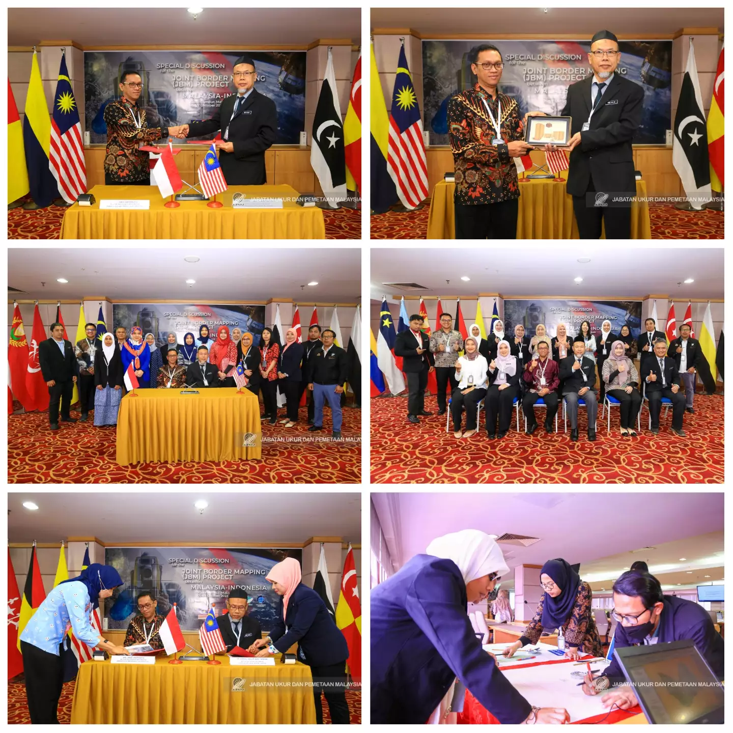
Special Discussion for the Joint Border Mapping Project between Malaysia and Indonesia (JBM) was held on 05-07 October 2022 at the 15th Floor Meeting Room, Wisma JUPEM.
This meeting was attended by an Indonesian delegation of 7 people led by Mr. Eko Artanto, Coordinator of International Boundary Mapping, Center for Boundary Mapping, Geospatial Information Agency, Indonesia. This meeting was chaired by Sr. Abdul Halim Bin Tuiran who is the Survey Director of the National Geospatial Database (BPDGN) to discuss technical issues in the preparation of the border map between Malaysia and Indonesia. This meeting is a scheduled meeting held twice a year in rotation between Malaysia and Indonesia.
The JBM Malaysia team consists of JUPEM officers namely Sr. Abdul Halim Bin Tuiran (National Geospatial Database Division Survey Director), Sr. Iza Zarina binti Abdu Razak (Sectional Survey Director, National Geospatial Database Division), Sr. Mohd. Johari bin Md. Sharif (Deputy Director of Surveys and Mapping II, JUPEM N. Sembilan), Sr Nur Shakila binti Tahir (Assistant Director of Surveys, National Geospatial Database Division), Sr Nurul 'Izzati binti Abdul Haris (Assistant Director of Surveys, National Geospatial Database Division) , Mr. Muhamad Akmal Bin Rusli (Assistant Surveyor, National Geospatial Database Division), Mr. Md Huzaini Bin Mohamed (Assistant Surveyor, National Geospatial Database Division), Miss Nor Hayati binti Mohamad Nor (Assistant Surveyor, Cartography and GIS Division), Mr. Nor Muhamat Zaidi Bin Md Isa (Assistant Surveyor, Cartography and GIS Division), Mrs. Sunita Binti Abd Lah (Assistant Surveyor, National Geospatial Database Division) and Miss Nurul Najihah Binti Azman (Assistant Surveyor, National Geospatial Database Division).